Friday
Sep012017

 Jeff Lehman
 Thanks to the folks who teach the Basic Search and Rescue Academy, the citizens of San Bernardino County, and the State of California have a new batch of SAR team members. Congratulations to the new crew members as they complete this first step in their training.
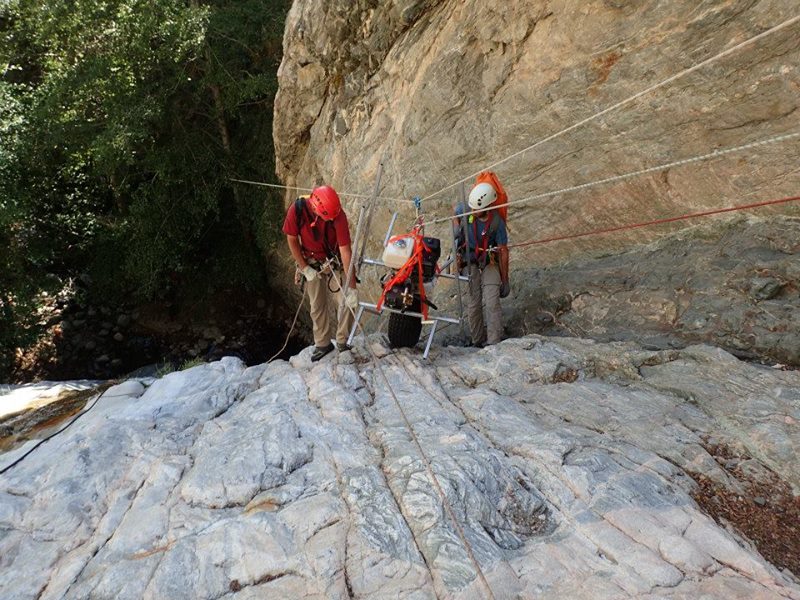
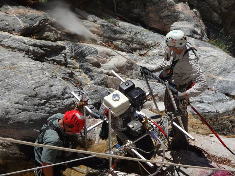
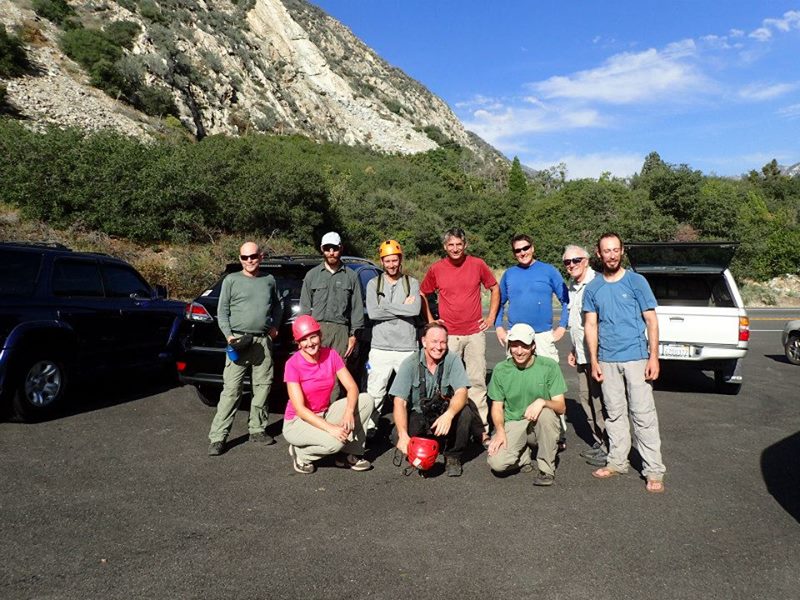
Sonny Lawrence Please applaud Bill Loenhorst from the San Gorgonio Search and Rescue Team and Hydrotek for once again stepping in to help with community cleanup projects. Two years ago, the Coalition of American Canyoneers (CAC) and the Cave and Technical Rescue Team created a plan to remove graffiti from waterfalls. We needed a relatively lightweight pressure washer to blast the graffiti off the rock. Bill, along with Hydrotek, stepped up and helped us build such a device. The CAC raised $1300 to pay for the wholesale cost of the machine. Here is an article about its maiden voyage. Over the past two years, Bill has periodically thought of various ways to improve on the device. Not only has he spent time on the improvements, he was also able to cover the costs (over $500) through generous donations from various companies. The Coalition of American Canyoneers has now used the pressure washer to remove graffiti in California and Arizona canyons. The next graffiti cleanup is slated for the end of July in Southern California.
Jeff Lehman
Jeff Lehman 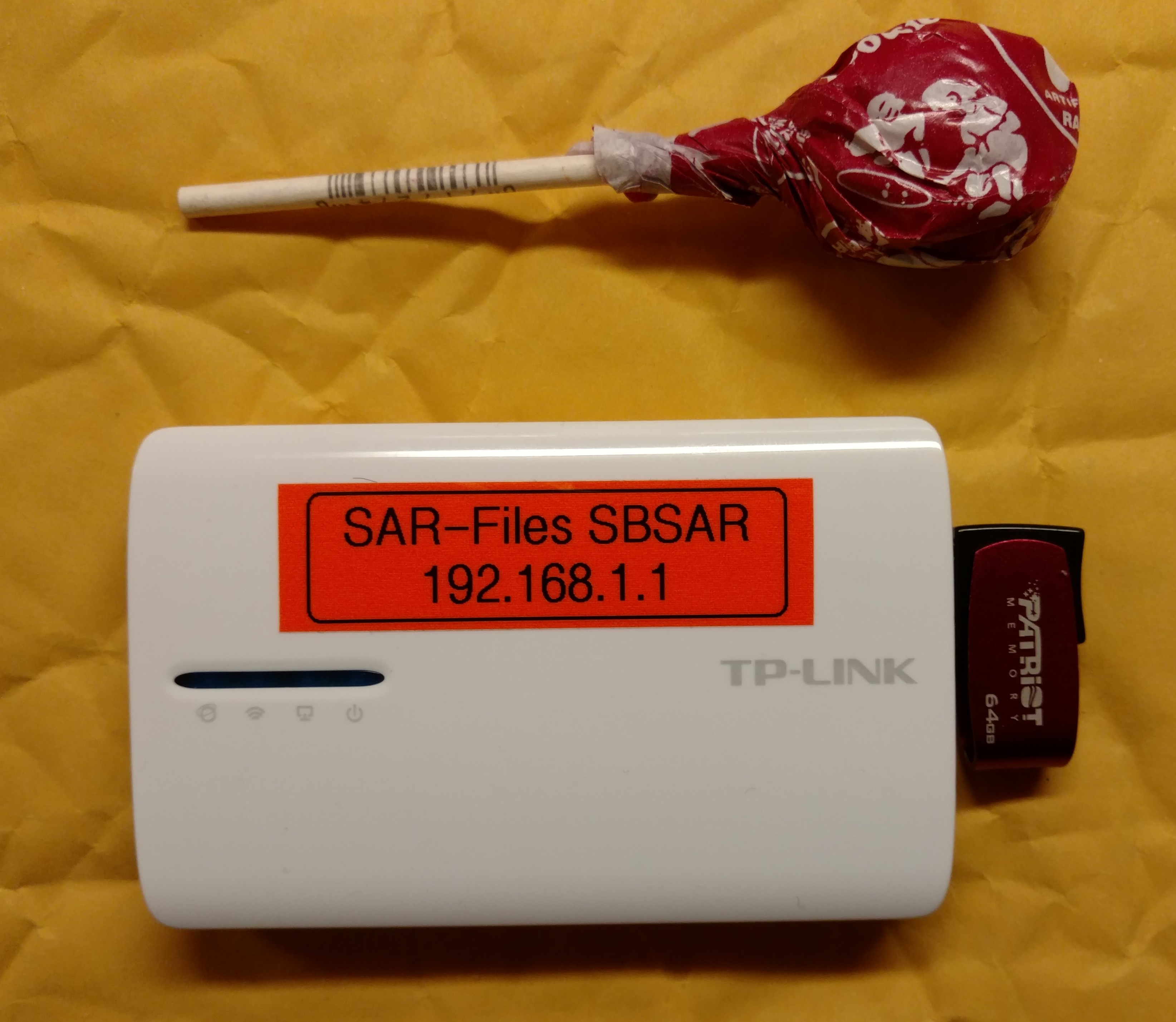 TP-Link MR-3040 wireless router. Tootsie Pop for scale.The smartphone continues to play an increasingly important role in search and rescue with all manner of apps available to assist SAR members in the field. More than anything else, I use my phone for land navigation. In fact, unless the weather is really bad, I rarely pull my dedicated GPS out of my bag. With my phone I can easily enter waypoints, scroll around on a map, and even use a decent compass. Earlier, I've mentioned specific apps that are handy, as well as ways to keep your phone powered throughout multiple operational periods, but there still remains the problem of moving data on and off the phone outside of cellular networks, and with minimal client-side requirements. Sure, it is relatively easy to provide FTP access to some command post files, but that would require that end users understand how to FTP and have the proper software loaded. This is not easily accomplished when there is no cell coverage. Enter Piratebox.
Piratebox, and its fork LibraryBox, allow file sharing outside of any internet connection. LibraryBox is a fork of the Piratebox project, and has similar functionality. The differences primarily lie in the ability to upload. Piratebox has a provision for file uploading by others, while LibraryBox is a, primarily, one-way operation; there is no provision for upload. Since it would be nice to be able to easily collect things like GPS tracks from phones, I figured that the ability to upload files would be helpful.
There are a handful of routers that are known to work with the Piratebox software, and I chose the TP-Link MR3040 because it comes with an integrated battery, and charges via a micro USB cable. To build your Piratebox, you flash the router with new firmware (OpenWRT) that has been modified to work with Piratebox, then install the Piratebox software. I won't replicate the directions here, but I followed them on the Piratebox site, and they worked fine.
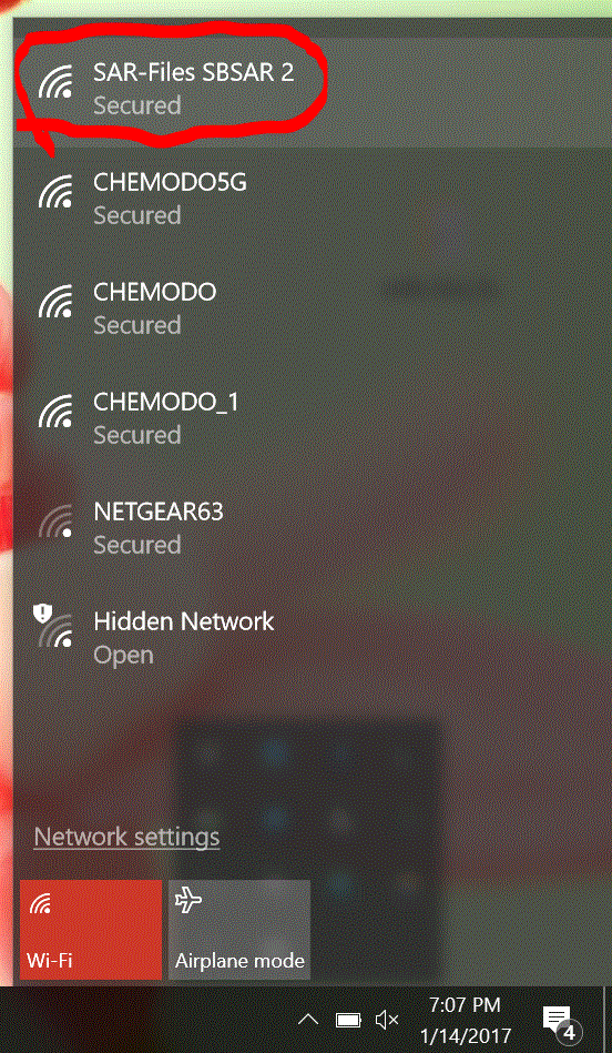 I changed my Piratebox SSID to be "SAR-Files SBSAR"When you are finished, you are able to share any files on an attached thumb drive. People access the files by connecting to the wireless router (Connect just like you would any WiFi hotspot. This one won't have internet access, though.). Once they are connected, they will be redirected to a browser window that shows a place to view files, and a box to upload files.
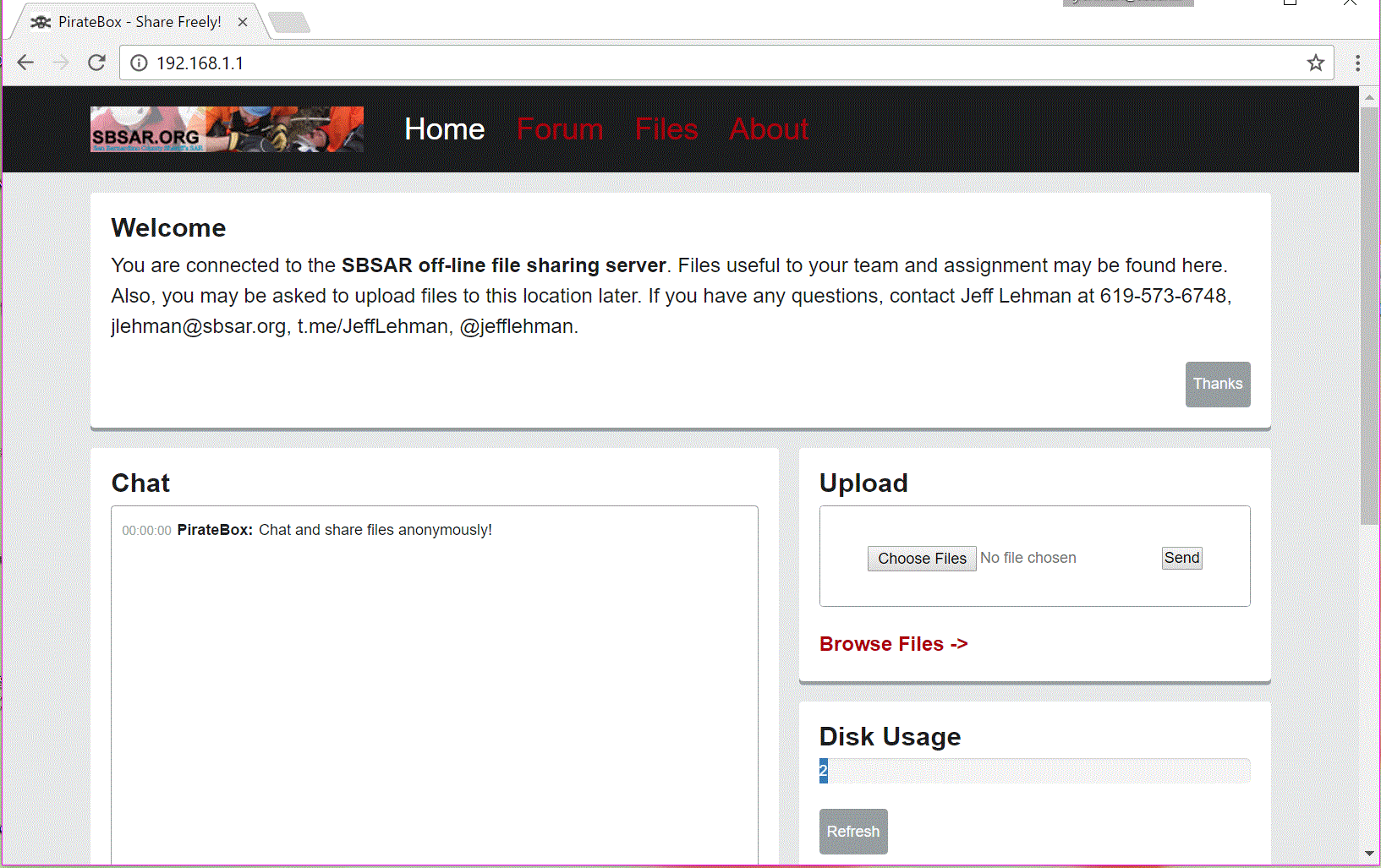 Landing page with customized header image and textThe whole install and configuration took about 30 minutes. I did make a few modifications, however. I modified the landing page text to reflect the use in SAR, and I changed the header image. I used the instructions from this thread to accomplish this. I changed the default SSID to "SAR-Files SBSAR" and configured file uploads to go to a different directory using the instructions on this page. Since I didn't want just anybody accessing the files on the Piratebox, I also put a password on the WiFi access using these instructions.
My goal with this project is to make .GPX/.KML files for all search assignments available for download to searcher's phones. Also to be included are PDF maps and other documentation such as photos, track prints, etc. So, rather than getting an assignment, and spending time entering in waypoints and such, the searcher can quickly download his/her area to include on the mapping program on their phone (Backcountry Navigator, Locus, Gaia, etc). The command post would load up the flash drive with the files, plug it into the Piratebox, and set it on the check-in table for SAR members to access at their leisure.
When the team returns, and has tracks and/or photos on their phones, they can connect to the Piratebox again, and upload their files. Later, the command post can pull the thumb drive and download all the files uploaded by the teams. Since everything is done with a web browser, no special software needs to be installed on the end-user's phone. This is key. Any solution that is designed to work outside of internet access, can't require a special app download since there will be no way to download the app without prior planning.
I have yet to try my Piratebox on an actual search, but it won't be long before the call arrives, and I will be able to give it a whirl. I will continue to update the links that I have found useful with this project at https://pinboard.in/u:jlehman/t:Piratebox. All of the links mentioned in this article are there. Drop me a line if you have any questions.
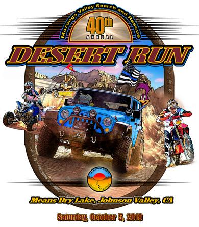
News Dave Larus 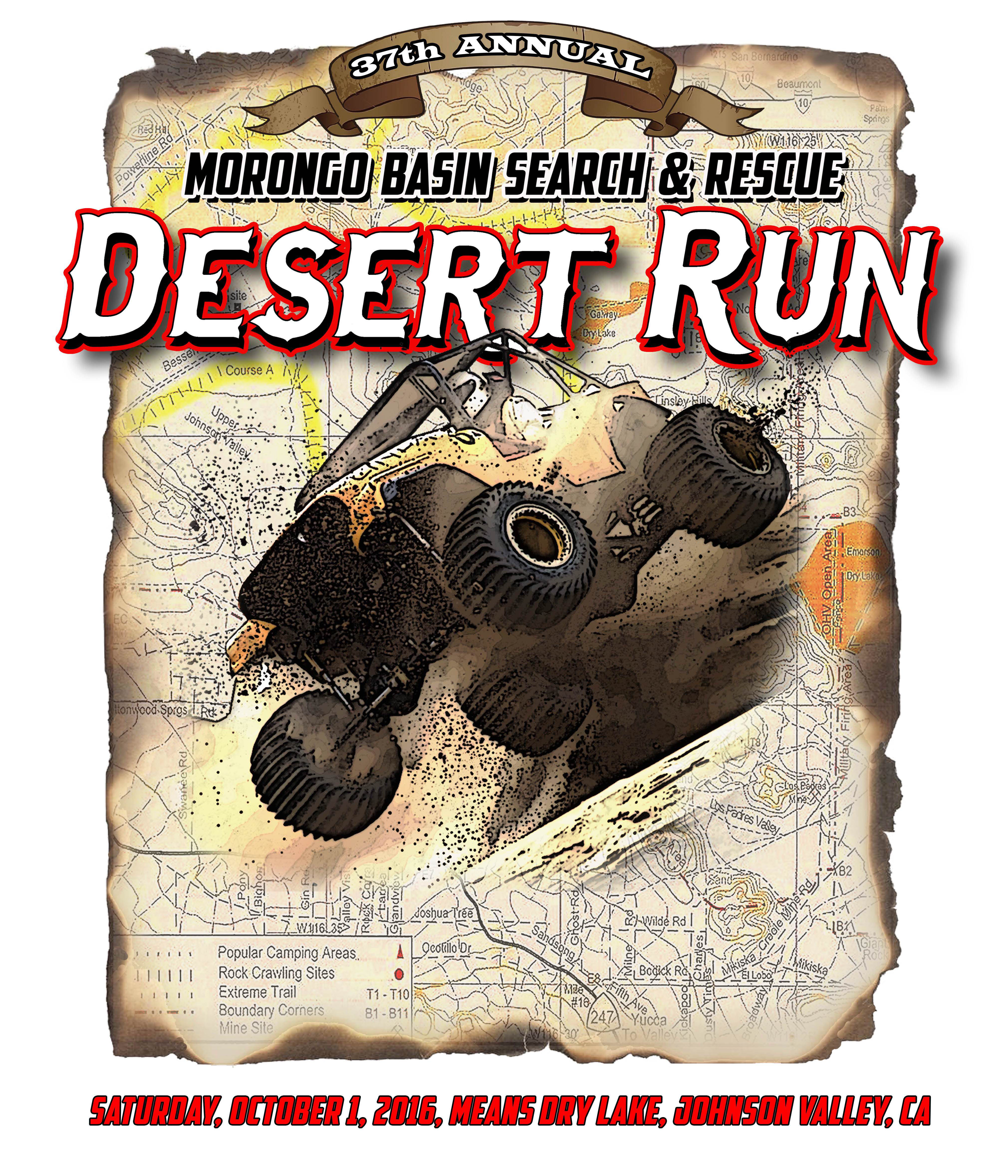 It's almost time again for MBSAR's (Morongo Basin, Unit 218) annual fundraiser; the "Desert Run". This is our 37th year and the event takes place on the 1st weekend in October. The actual Run this year is on Saturday the 1st of October but MBSAR members will be preparing all week for this popular event. We have the whole weekend planned for your enjoyment!
You can register at the event on Friday, September 30th at our Base Camp or you can pre-register online at www.desertrun.org and get a $5 discount. We have a schedule of events and a Menu for the weekend in a flyer that's available at our website (www.desertrun.org). You can also visit us on Facebook: desert run - morongo basin search and rescue. Also, the flyer will provide you with any other information that you may want to know about the event. Or you can call Renee @ 951-203-6816 or Josh Lewis @ 760-275-8514. Thanks for your support of the Morongo Basin Search and Rescue Team. All profits go toward support and training of the Unit!
News Jeff Lehman The burn area of the Blue Cut Fire and some of the surroundings have been closed. Please check out the map, as the area closed is larger than the burn area. Click the map to download a PDF.
Download the Forest Order
Download the Map
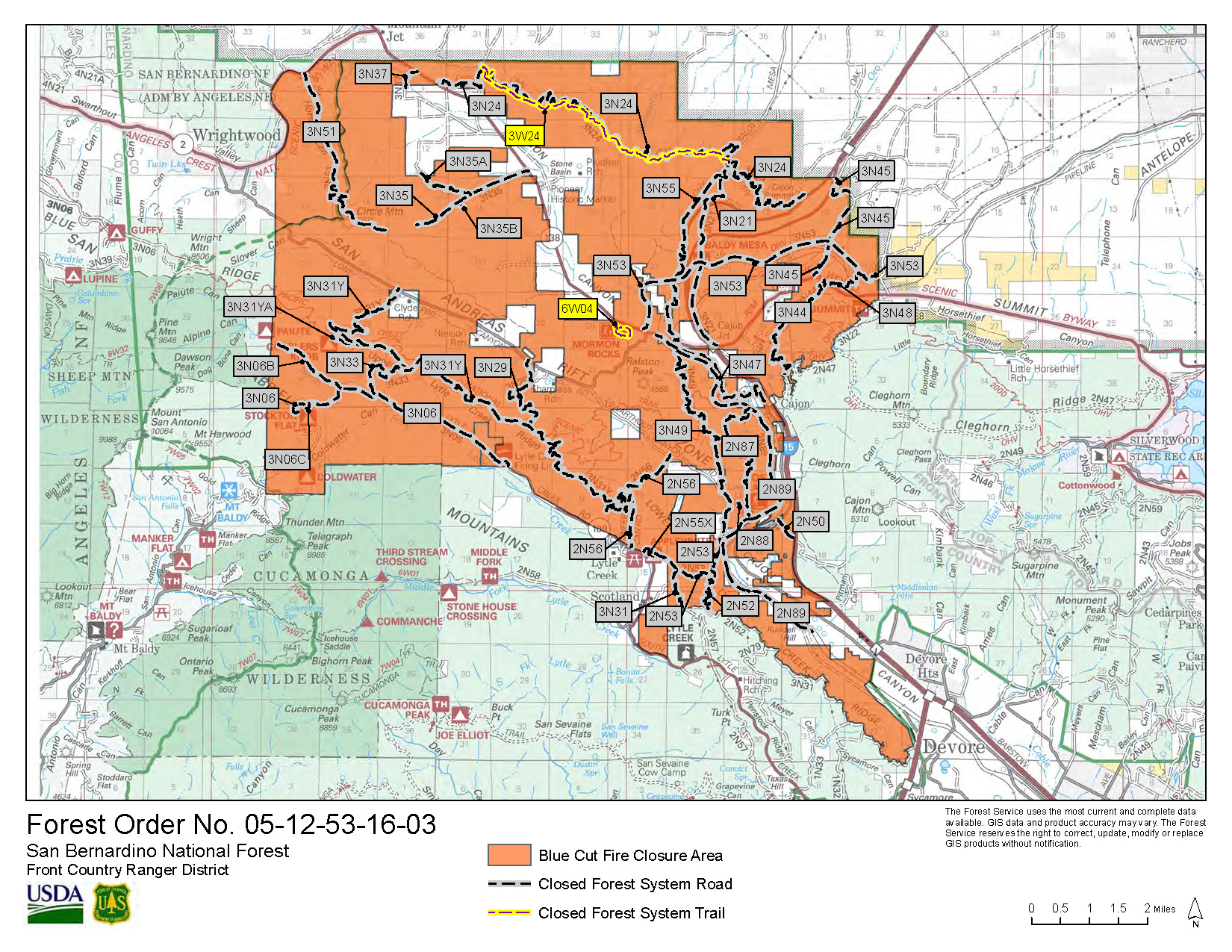
Jeff Lehman Fire information is available at inciweb.nwcg.gov/incident/4962/
Sonny Lawrence The formula for determining the lecture date for the Basic Mountaineering Course has changed. In the past it was held on the weekend before Thanksgiving. The new formula is to hold it on the weekend directly following the second Friday of November. Hence this year it will be held November 12 and 13. Please spread the word and mark your calendars. More details concerning signups will be distributed via email and online out as we get closer.